
Strong El Niño Developing – What It Could Mean for the 2026/27 Summer.
1 September 2026 - Strong El Niño Developing – What It Could Mean for the 2026/27 Summer.
The South African Weather Service (SAWS) has issued an important update regarding the developing 2026/27 El Niño, with current forecasts indicating that the event could become exceptionally strong during the coming spring and summer.
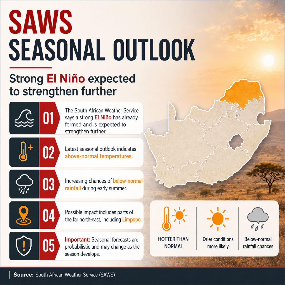
According to SAWS, a strong El Niño has already formed in the Pacific Ocean and is expected to strengthen further during the next few months. Current predictions indicate that the event may develop into a very strong El Niño and persist through much of the 2026/27 summer season.
For communities across Greater Tzaneen, Greater Letaba and Limpopo, the most important message is not that drought or extreme heat is guaranteed.
It is that the risk profile for the coming summer is changing, and early preparation is important.
What SAWS Is Currently Forecasting:
The latest SAWS Seasonal Climate Watch, issued on 31 August 2026, indicates that El Niño conditions are strengthening and that the typical signs associated with a warmer and drier South African summer are beginning to appear.
During spring, favourable rainfall conditions may still occur over parts of the eastern coastal regions and eastern interior.
However, as the country moves toward early summer, significant areas are expected to experience below-normal rainfall, particularly the central interior and the far north-east of South Africa.
SAWS specifically identifies Limpopo among the areas where below-normal rainfall is expected during early summer.
At the same time, both minimum and maximum temperatures are expected to be above normal across much of the country during spring and early summer.
A Potentially Very Strong El Niño:
In its statement dated 1 September 2026, SAWS reported that sea-surface temperature anomalies in the tropical Pacific were already exceeding thresholds associated with a very strong El Niño.
Current model guidance indicates that the event could intensify further, potentially becoming one of the strongest El Niño events observed in modern records.
Historically, many El Niño events have been associated with:
Below-normal rainfall over southern Africa,
Above-normal temperatures,
Increased drought pressure,
Greater water stress,
Increased frequency of heatwaves.
SAWS also points out, however, that not every El Niño produces the same outcome.
For example, the very strong 1997/98 El Niño did not result in widespread drought across all of South Africa's summer-rainfall regions.
Seasonal forecasting therefore provides a probability and preparedness signal, not a guarantee of exactly what will happen.
What This Could Mean for Limpopo:
For the Greater Tzaneen and Greater Letaba areas, several parts of the outlook deserve close attention.
Higher Temperatures:
Above-normal maximum and minimum temperatures are forecast across much of South Africa during spring and early summer.
Higher temperatures can increase:
Evaporation,
Water demand,
Heat stress,
Drying of vegetation,
Stress on crops and livestock,
Fire-weather risk when combined with dry and windy conditions.
Possible Below-Normal Early-Summer Rainfall:
The SAWS outlook identifies the far north-east, including Limpopo, as one of the areas where below-normal rainfall is expected during parts of early summer.
If this develops as forecast, the region could experience faster drying of vegetation and continued pressure on water resources.
Spring Rain Is Still Possible:
It is equally important not to misinterpret the forecast as meaning that no rain is expected.
SAWS indicates that favourable rainfall remains possible over eastern parts of South Africa during spring, and some eastern areas may continue to receive above-normal rainfall into parts of early summer.
The seasonal pattern may therefore be uneven, with periods of good rainfall followed by hotter and drier conditions.
What This Means for Fire Risk:
A seasonal climate forecast is not the same as a daily Fire Danger Index.
A veldfire can still occur on a relatively moderate weather day, and a high-risk fire day can occur even within an otherwise wet season.
However, prolonged periods of:
Higher temperatures + lower rainfall + drying vegetation
can gradually increase the amount of combustible fuel available in the environment.
For the firefighting community, this means the developing 2026/27 summer should be watched carefully.
Vegetation conditions, rainfall, humidity, wind and daily Fire Danger Index values will remain far more important for determining the immediate fire risk on any specific day.
Agriculture and Water Availability:
The SAWS Seasonal Climate Watch also highlights potential implications for agriculture and water resources.
While favourable spring rainfall may support crops and livestock in eastern areas, the expected shift toward hotter and potentially drier early-summer conditions could increase pressure on:
Irrigation water,
Farm dams,
Soil moisture,
Crops,
Livestock,
Household and municipal water supplies.
SAWS encourages farmers in areas expecting lower rainfall to consider soil and water conservation, water harvesting and storage, and other appropriate farming practices.
For an agricultural region such as Greater Tzaneen and Greater Letaba, these developments deserve continued attention.
Heatwaves May Become an Important Concern:
SAWS warns that if the expected very strong El Niño coincides with below-normal rainfall, frequent and potentially severe heatwaves may occur across southern Africa.
Above-normal temperatures can place additional pressure on:
Children,
Older persons,
Outdoor workers,
Firefighters and emergency responders,
People working in agriculture and forestry,
Animals and livestock.
Adequate hydration, shade, rest periods and monitoring of official heat warnings become particularly important during prolonged hot weather.
This Is a Seasonal Outlook – Not a Certainty:
Seasonal forecasts must always be interpreted carefully.
They describe the most likely conditions over a period of several months, rather than predicting the weather for a particular day or week.
SAWS itself emphasises that uncertainty remains regarding the eventual strength and regional impacts of the developing El Niño.
The outlook is also updated monthly, meaning the expected rainfall and temperature patterns may change as new information becomes available.
For this reason, Asterix will continue following:
Monthly SAWS seasonal forecasts,
Daily and short-term weather forecasts,
Fire Danger Index information,
Fire Protection Association notices,
Official fire restrictions and warnings.
Preparation Is Better Than Reaction:
The purpose of sharing this information is not to create alarm.
It is to encourage early awareness and preparation.
For landowners, farmers, forestry operations and communities, the coming months are a good opportunity to review:
Firefighting equipment,
Water availability,
Pumps and hoses,
Firebreaks,
Emergency access,
Communications,
Contact numbers,
Vegetation and fuel accumulation,
Emergency response plans.
Weather conditions may ultimately differ from the current seasonal outlook.
But preparedness completed before high-risk conditions arrive is never wasted.
Asterix Will Continue Monitoring the Outlook:
Asterix The Long Firefighting Dog NPC – Fire & Emergency Support Service will continue monitoring official SAWS forecasts and relevant fire-weather information as the 2026/27 season develops.
Where significant changes affect Greater Tzaneen and Greater Letaba, we will continue sharing relevant public-safety information with the community.
The most important point at this stage is simple:
A very strong El Niño is developing, hotter conditions are expected, and the possibility of a drier early summer in Limpopo deserves attention.
Preparation should begin before those conditions become an emergency.
Sources:
This community update is based on official information issued by the South African Weather Service:
Seasonal Climate Watch – September 2026 to January 2027
Issued: 31 August 2026. South African Weather Service Statement on the 2026/27 El Niño
Issued: 1 September 2026.
Join the Group:
Asterix Community Emergency Reporting – Greater Tzaneen & Letaba
https://chat.whatsapp.com/I8kj4N67kh4CHJqqSCTv0o?mode=gi_t
Emergency Reporting:
For an uncontrolled fire or other active emergency:
24/7 Emergency Line: 015 590 8911 - Please phone this number first.
Dispatch WhatsApp: 079 624 2809
When reporting a fire, provide the most accurate location possible and advise, where safely known, what is burning, whether the fire is spreading and whether homes, people, vegetation or other property are threatened.
AURA | iER | NAMOLA may also be used as additional emergency-reporting channels where appropriate.
Asterix The Long Firefighting Dog NPC
Fire & Emergency Support Service